

AEC Sector
Our solutions streamline design, collaboration, and execution in the AEC industry, enhancing precision and efficiency.
Read More

Ansimap Technologies Private Limited (ATPL), founded in 2015, is an ISO 9001:2015 (QMS) & ISO 27001:2013 (ISMS) certified Geospatial & Engineering Consulting Company offers innovative, value-added Spatial Engineering Solutions around the Globe.
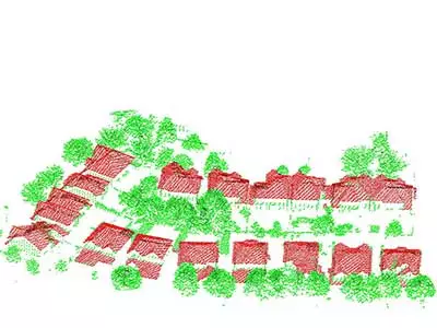
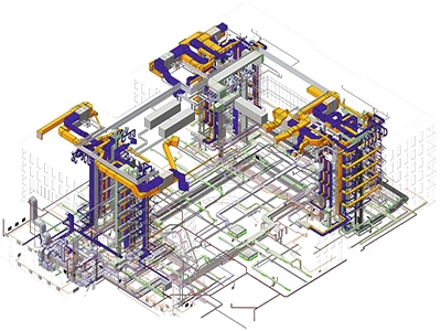
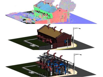
From 3D modeling and clash detection to 4D scheduling and 5D cost estimation, we provide tailored Building Information Modeling (BIM) solutions to streamline your construction projects, improve collaboration, and enhance project outcomes. revolutionising the architecture, engineering and construction (AEC) industry.
Ansimap has been a pioneer in providing Enterprise GIS and software solutions to Utilities, Telecom, Land Administration, Mining and other geospatial industries. We bring horizontal and vertical integration of Satellite/Aerial Remote Sensing, Positioning Applications, Photogrammetry, GIS Databases and Applications, GIS Web-services and Networking of GIS Databases.
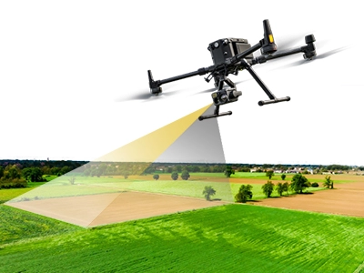
At Ansimap, we offer a wide range of services, including geospatial solutions, Building Information Modeling (BIM), drone surveys, and advanced mapping technologies.
Skilled Employees
GeoSpatial Projects
BIM/Engineering Projects
Happy Clients
Ansimap's AI-powered solution revolutionizes data annotation and labeling, enabling precision and efficiency across industries like powerline inspection, vegetation management, and mining.
Our artificial intelligence (AI) based Powerline Inspection solutions detects, track and notify the faults and predictive vegetation growth automatically to ensure grid security and maintenance.
Contact UsWhether you're working on AI and machine learning projects, developing autonomous systems, or managing large datasets for research, our data annotation and labeling services ensure that your data is meticulously labeled, structured, and ready for seamless integration into your applications.
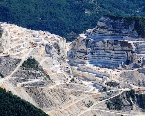
Contact UsOur Mining solutions provide more precise volumetric measurements of stockpiles and historical data analysis helps to increase efficiency, improve safety and streamline the mining operations by creating the digital terrain models from the drone data
Contact Us
Our solutions streamline design, collaboration, and execution in the AEC industry, enhancing precision and efficiency.
Read More
Empowering the Power & Electricity industry with precision GIS mapping and innovative design solutions.
Read More
Enabling precise geospatial analysis, real-time route optimization, and seamless integration with navigation systems.
Read More
GIS-based mapping and spatial analysis solutions, optimizing workflows and data management for the land administration.
Read More