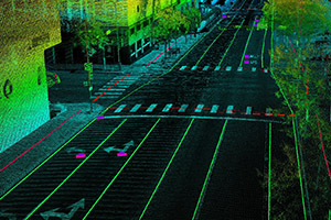
ANSIMAP offers wide range of LiDAR data processing services such as Flightline/Scan Matching, Point cloud classification, Digital Elevation Models (DTM/DEM), Contour Mapping, Powerline processing, Mobile Mapping and advanced geospatial analysis.
We have an experienced team of engineers and technicians who have worked with multiple industries, helping them achieve their goals.
We have delivered LiDAR services to our global clients in multiple industries including transportation, utilities, telecommunications, Forestry, mining, and Agricultural firms.
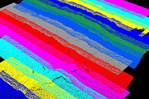
While scanning the scanner may have an error due to angles of laser travel as the laser instrument is not perfectly aligned with the aircrafts head, roll, pitch. There may be differential shaking of the laser scanner and INS. Further, the measurement of scanner angle may have an error.
The misalignment between the laser scanner and the Inertial measurement unit (IMU) may require additional calibration parameters for strip adjustment as well. Those must be solved using more manual methods with system-specific software.
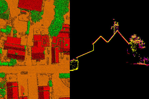
We offer high detailed LiDAR point cloud classification services, be it simple bare earth (ground vs non-ground) or the most complex & advanced classification.
The classified LiDAR data has numerous application such as DEMs, Forest Planning & management, Agriculture, City Models etc.

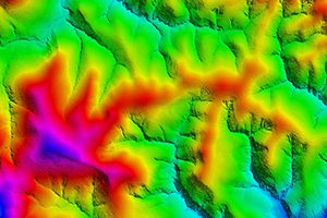
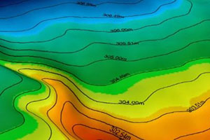
A digital elevation model (DEM) is a 3D representation of the earth’s surface elevations. A Digital Terrain Model (DTM) is a DEM in which terrain data has been further enhanced with breaklines, creating greater accuracy as it contains additional information defining terrain effectively.
We create high quality Digital Elevation Models (DEMs) and Digital Terrain Models (DTMs) to support specialized applications such as 3D Modelling, volumetric calculations, contour generation, Orthophoto rectification, and flood plain mapping etc.

A contour maps consists of contour lines which are imaginary lines connecting points of equal elevation that correspond to the orthometric heights of the bare earth surface. The contour lines in an area are generated using the Digital Terrain Models (DTMs) keeping difference in elevation of between two consecutive lines constant.
We create highly accurate contour lines using the Digital Terrain Models (DTMs) for the Topographic maps. We deliver the Contour maps in multiple vector formats (.dwg, .dxf, .shp etc.).

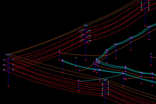
LiDAR data is a very reliable method of mapping and analysis of power transmission and distribution lines. Due to the high density it helps to map and extract the catenary and other information accurately.
We offers a detailed point cloud classification such as conductors, shield wire, towers, sub-stations, ground, vegetation, building & other features for power transmission and distribution lines which can be used for various analysis.
We also offers accurate 2D and 3D power line models such as towers, tower top-bottom points, catenary, conductor attachments, insulator attachments from LiDAR and imagery at a very efficient cost.
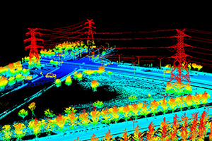
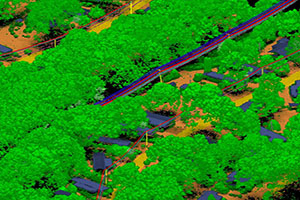
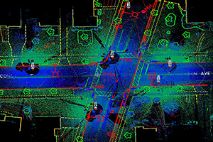
Mobile LiDAR is an innovative mapping solution that combines the LiDAR data with high resolution imagery & videos to collect survey grade 3D point cloud data quickly and accurately. It offers numerous advantages over conventional ground surveys. It provides a rich dataset with a very high data density for close range acquisition.
What we do?
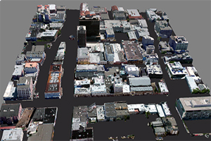
3D city models are digital models of urban areas that represent terrain surfaces with all its features. These features include aforesaid virtual features as well as other physical furnishings such as buildings, landmarks, vegetation, infrastructure landscapes, and terrain. Their components are described and represented by corresponding two-dimensional and three-dimensional spatial data and geo-referenced data.
3D city models are visually integrating various geospatial elements to real-world scenarios with all its complexities. Creation of automatic 3D city models involves preparation of database based on the required level of details, storage of the same in a database, construction and detailing of city models and visualization of the same through various application platforms.

Let us know if you have any interesting project and want to discuss? We will help you with optimal solutions.