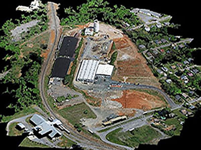
Colorised point cloud & DSM
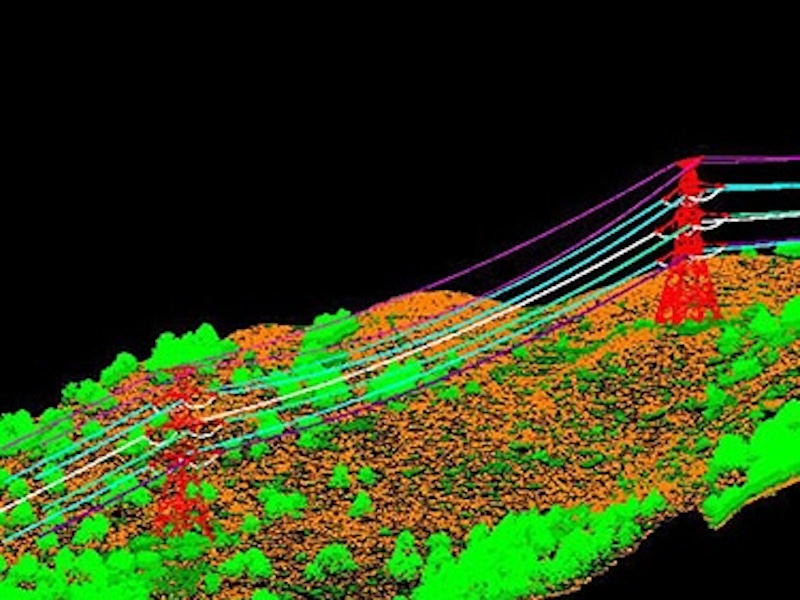
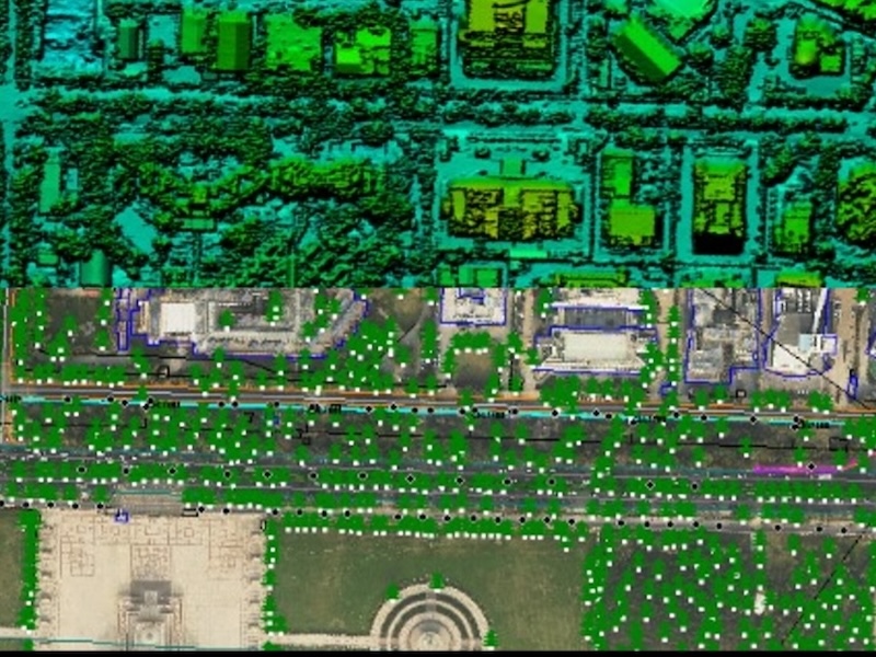
Transmission line Point cloud classification
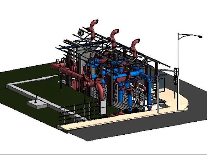
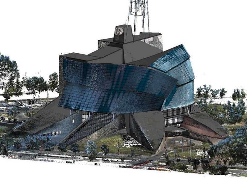
Detailed 3D BIM Models
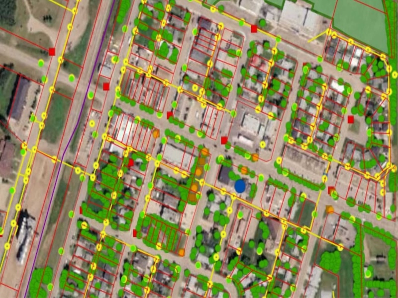
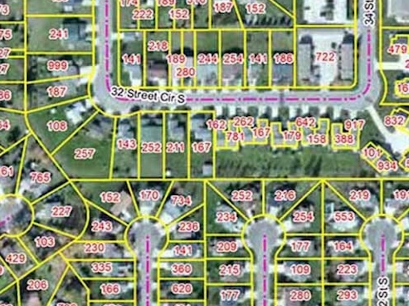
Parcel Maps with properties informations.
Scan to BIM model from Point Cloud
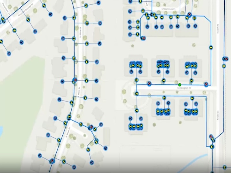
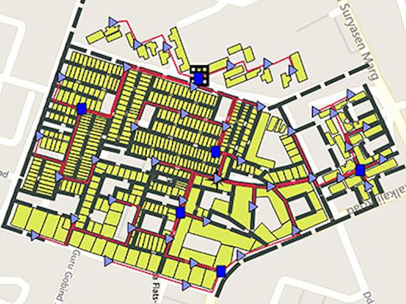
Parcel maps with Electrila disribution network..
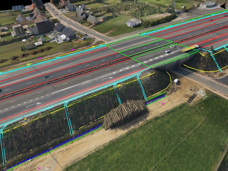
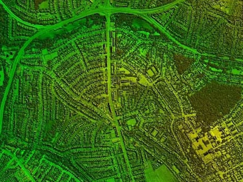
3D Topographic maps from drone ortho imgery.
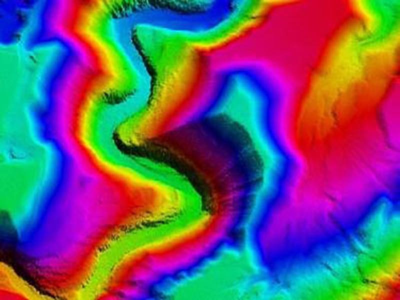
LiDAR DEM from classified LiDAR data.
Integrated DSM & Topographic maps.
Architectural BIM Models from LiDAR scan data.
Telecom network design and mapping
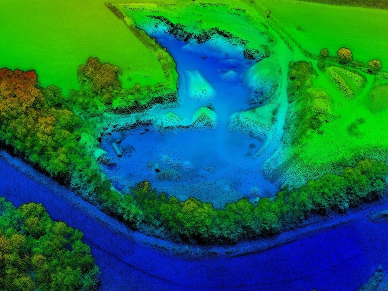
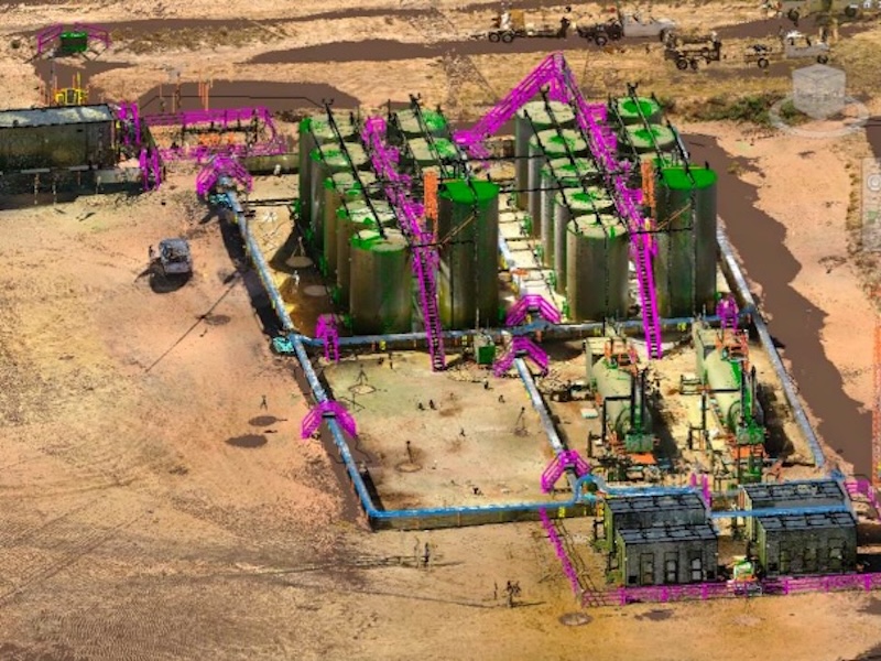
DEM from photogrammetry survey of a dumpyard.
GIS data on top of web maps
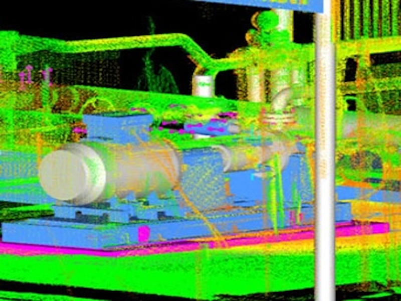
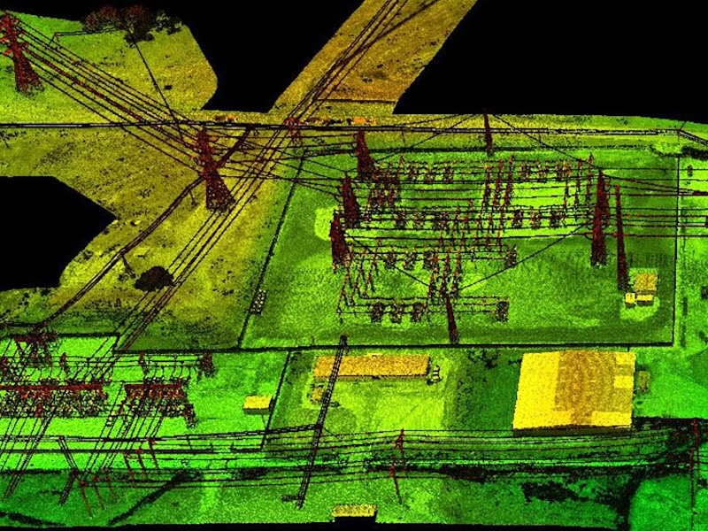
LiDAR survey of powerline substation.
Digital Surface Model from Aerial LiDAR
Scan to BIM Model