May 17, 2025
LiDAR's ability to capture precise and detailed data in real-time is revolutionizing the way railways operate, enhancing safety measures, improving infrastructure maintenance, and optimizing operational efficiency.
#lidar #mapping #railways #assetmanagement #utility
LiDAR Technology Overview:
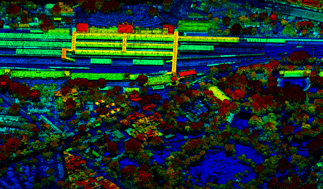
LiDAR is a remote sensing technology that uses laser light to measure distances with high precision. By emitting laser pulses and measuring the time it takes for them to return after hitting an object, LiDAR systems create detailed three-dimensional maps of the surrounding environment. These maps, often referred to as point clouds, provide accurate spatial information that can be utilized for a myriad of applications in the railway sector.
Applications of LiDAR in Railways:
Track Inspection and Maintenance: LiDAR-equipped systems mounted on trains or specialized vehicles can rapidly scan and assess the condition of railway tracks. This real-time data helps identify potential issues such as track misalignments, wear and tear, and structural defects. By detecting these problems early, maintenance crews can proactively address them, minimizing downtime and ensuring the safety of railway operations.
Obstacle Detection and Clearance Analysis: LiDAR's ability to create detailed 3D maps aids in identifying obstacles along the railway corridor, including vegetation, structures, or other encroachments. This data is crucial for clearance analysis, ensuring that there is adequate space around the tracks to accommodate the safe passage of trains.
Tunnel and Bridge Inspection: LiDAR technology is particularly useful for inspecting tunnels and bridges. Its capability to penetrate and capture detailed information in confined spaces makes it an ideal tool for assessing the structural integrity of these critical railway infrastructure components.
Vegetation Management: Overgrown vegetation near railway tracks can pose serious safety hazards. LiDAR data helps in monitoring and managing vegetation growth along the rail corridor. By identifying areas where vegetation may encroach upon the tracks, railway operators can plan and execute timely maintenance activities.
Surveying and Mapping: LiDAR technology assists in creating accurate and up-to-date topographic maps of railway networks. This information is valuable for planning new rail routes, optimizing existing networks, and facilitating infrastructure development.
Benefits of LiDAR in Railways:
Enhanced Safety: LiDAR's ability to detect obstacles and assess track conditions in real-time significantly enhances railway safety by minimizing the risk of accidents.
Cost-Efficiency: Proactive maintenance based on LiDAR data reduces the overall maintenance costs and extends the lifespan of railway infrastructure.
Operational Efficiency: LiDAR aids in optimizing railway operations by providing accurate and timely information for decision-making, leading to improved efficiency and reliability.
Environmental Impact: Efficient vegetation management based on LiDAR data contributes to reducing the environmental impact of railways by preventing overgrowth and minimizing the need for chemical treatments.
In Conclusion, LiDAR technology is reshaping the railway industry by providing a new dimension of precision and efficiency. As railways worldwide continue to adopt innovative solutions for safety and performance, the integration of LiDAR technology emerges as a critical step towards a safer, more reliable, and sustainable future for rail transportation.